Architecture & property
Put a proposal in its real surroundings. Show a new building, compare sightlines, explore access and communicate the neighborhood around a development.
A real location, turned into a fully mapped digital city. For architectural visualization, film and previz, education, simulation, video games—and whatever you want to build next.
Choose an area. Get a usable world. Make it yours.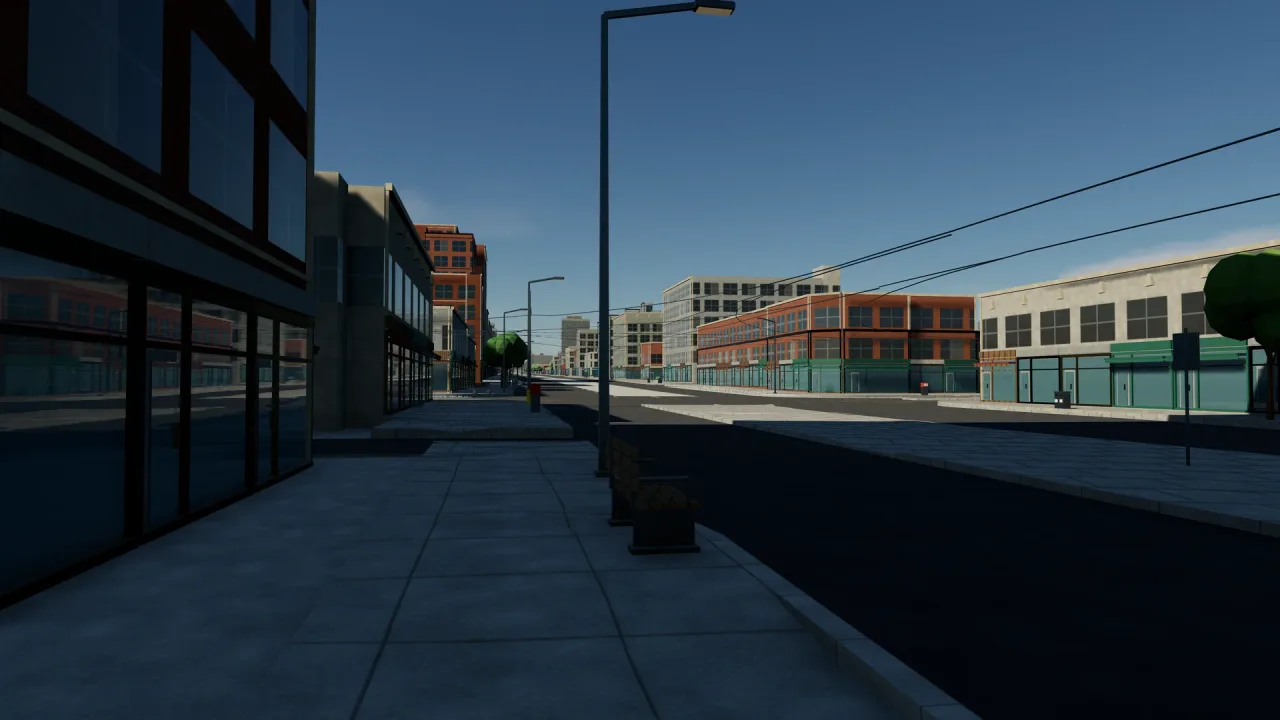
Skip the long stretch between “we need this location” and having somewhere useful to work. Keep a practical digital clone, or take it all the way to a distinctive, authored world.
Put a proposal in its real surroundings. Show a new building, compare sightlines, explore access and communicate the neighborhood around a development.
Scout a digital location, plan camera paths and blocking, establish scale and sightlines, or build the city around your virtual production.
Give geography, urban history, transit and spatial questions a place people can explore instead of another flat illustration.
Start with a recognizable open world and a data layer your gameplay systems can use. Spend production time on the experience.
Use mapped roads, terrain and pedestrian routes as a foundation for transport scenarios, training environments and interactive demonstrations.
Build a museum installation, destination tour, planning presentation or stylized place. A digital city is useful wherever location and spatial context matter.
We deliver a data-driven, deterministic procedural generation module with simple configuration, the generated city and an organized asset handoff. Keep the seed and rules, and regeneration stays predictable. Change the content without throwing away the geography.
Real-world scale, 1:1 mapped building shapes and footprints, addresses, neighborhood tags and source-linked identities. Find a building by its address instead of guessing which anonymous mesh it became.
Elevations, streets, sidewalks, populated parks, trees, benches, plazas and pedestrian spaces. A location should feel like a place from the ground, not only from above.
Mapped transit routes, corridors and stops, plus AI navigation waypoints for vehicles and pedestrians. Connect your movement, simulation and gameplay systems to a world that already knows its structure.
Shared asset categories and material bindings let a change reach every matching placement. Supply a replacement or a configurable set of variants, rather than manually editing each instance.
Custom 3D modeling for the buildings, landmarks and important areas your project depends on. We also offer full environment modeling when your brief needs a completely authored finish.
Scene organization, reusable assets, configuration, tags and the agreed collision, navigation, streaming and lighting setup. Ready to put to work in the use case you commissioned it for.
Three straightforward steps to a game world. Two may be all you need for a digital clone, visualization or stylized project.

Send a boundary, your intended use and your target engine or production tools. We agree coverage, source data, detail priorities and the handoff. A downtown foundation can be delivered in five days or less once the brief and inputs are ready.
Landscapes, city streets, parks and public spaces. Explore the slideshows or grids, then compare the same world under different light.
Select an image to explore it at a larger size. Galleries combine 4K high-detail and HD standard-detail captures, labelled individually.
The Rogers Centre roof is more than a shape on the skyline. Watch the panels open and close, then inspect the closed, opening and open positions.
Need a landmark that does more than look the part? On request, we can build animated, simulated or triggerable versions of the features your project needs—from the Rogers Centre’s moving dome to a small mechanism in a public space. Large or small, we shape the motion, controls and interactions around your gameplay, cinematic, visualization or simulation requirements.
 ROGERS CENTRE / CLOSED · DAY · EPIC
Captured roof animation · 720p high-detail. Playback starts only when you choose it.
Follow the same camera from dawn through daylight, dusk and night. Drag the comparison, step through the hours or see all four together.
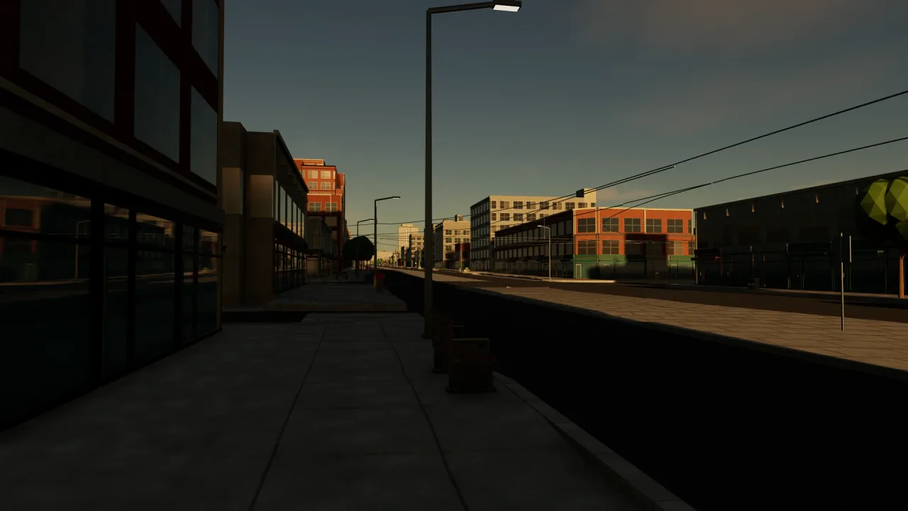
Drag anywhere on the image, or use the focused slider’s arrow keys.
Street life / four times of day / 4K high-detail environment captures
Shared bindings separate what an object is from the mesh and materials used to show it. Replace the bench category and the placeholders disappear throughout the city. Add several benches and choose deterministic random variation, neighborhood-specific sets or rules based on the location and surrounding data.
Your delivery includes an asset SKU sheet: category and variant IDs, materials, size and placement conventions, and priorities. Give your own artists or an external modeling and scanning studio a practical brief.
Use an existing library, commission high-definition scans or models, or ask us to create them. We work with common model interchange formats including FBX, glTF/GLB, OBJ and USD, and assets from Fab, Unity Asset Store and other libraries, preparing them for your chosen engine.
Map the finished assets and materials to the supplied categories. One configuration change replaces every matching use while the city keeps its identities and procedural structure. Already have access to an asset library? We can do the model and material swaps for you.
| SKU / category | Art to supply | Placement rule |
|---|---|---|
| PARK.BENCH | Bench models + materials | Park and neighborhood sets |
| STREET.TREE | Tree families + seasonal materials | Street type, district and seeded variation |
| CIVIC.PAVING | Surface materials + detail modules | Plazas and important pedestrian areas |
Illustrative categories; your sheet follows your city and the detail you need.
Unreal Engine, Unity, Godot, Bevy or a custom renderer: tell us your target. We tailor the scene, asset conversion and data handoff to the tools you use.
Bring your area—or your asset library ↗Our Toronto development scene runs around 60 FPS on 11th-generation Intel Iris Xe integrated graphics, with high-detail rendering settings, real-time software global illumination, reflections and volumetric fog. The development CPU is an Intel Core i7-1165G7; the city workflow is designed to avoid turning the environment into a CPU bottleneck.
With the editor attached, unusually fast camera movement or heavy competing workloads, the same scene can sit nearer 40 FPS. The point is practical headroom: a dense city that leaves room for the experience you are building.
| City-scene profile | CPU | Graphics | Memory & storage |
|---|---|---|---|
| Minimum / city viewing | Quad-core, eight-thread Intel or AMD, 2.5 GHz class or better | 11th-gen Intel Iris Xe or better, current driver | 16 GB dual-channel RAM · SSD |
| Recommended / Toronto reference class | Intel Core i7-1165G7 or comparable modern quad-core | 11th-gen Intel Iris Xe or better | 32 GB dual-channel RAM · NVMe SSD |
| Ideal / production headroom | Modern six-core / twelve-thread CPU or better | Dedicated DirectX 12 GPU · 8 GB+ VRAM | 32–64 GB RAM · NVMe SSD |
Toronto is a dense city and a useful reference for this workflow. Every area and finished project has its own demands: coverage, asset detail, crowds, simulation, resolution and rendering choices affect the result. We set the delivery budget around your use case; a particular frame rate is not guaranteed for every location or final application.
For Unreal-based production, Epic’s engine and editor requirements also apply to your chosen features and development workflow.
Digital Cities began as the workflow for the open world of Ascension, our in-house A-life cyberpunk immersive simulator. We needed real structure: geography, addresses, movement and the small details that make an open world feel connected.
Extensive proprietary tool development made geographic preparation, deterministic generation, tagging, asset binding and environment work one repeatable process. It was so fast enough to produce a downtown foundation in five days, rather than model each placement by hand that we decided to offer the service to the world.
You benefit from that investment now: a downtown foundation in five days or less, with a clear route from mapped location to your finished world. Our tools do the repetition. Your brief determines where the craft goes.
The foundation combines mapped geography with procedural and authored detail. One-to-one scale and mapped building shapes describe the city structure; bespoke facade, interior and landmark fidelity are set by your modeling brief. The Toronto galleries show our reference-guided environment and lighting work.
Contains information licensed under the Open Government Licence – Toronto and elevation data under the Open Government Licence – Canada.
Send the area, intended use, target tools and any asset library you want us to use. We’ll scope the city, the art and the delivery schedule. Architecture, film, education, simulation or a new open world—start with the place.
Get your Digital Cities brief started ↗* About the five-day turnaround. Five days is our standard city-foundation turnaround, based on the Toronto demo and client projects. Specific requests, substantial additional custom work approved by you, integration support and factors beyond our control may add to the timeline. We agree the scope and schedule with you, and discuss any changes as the project develops.